The Four Quadrants of Mueller
How the Neighborhood Grew
Much like Rome, Mueller wasn’t built in a day. It wasn’t even built all at one time. The neighborhood that today includes thousands of homes and apartments, parks and trails, schools, major employers, shops, restaurants and cultural institutions took nearly two decades to build.
And the plans for it started much earlier.
The redevelopment of Austin’s former Robert Mueller Municipal Airport grew out of decades of community planning. The 1984 Citizens for Airport Relocation plan called for a “new town in-town,” with compact development that would also be compatible with the surrounding neighborhoods.
By 1996, a City Council-appointed redevelopment task force was calling for a compact, pedestrian-oriented, mixed-use community. The City of Austin approved the RMMA Reuse and Redevelopment Plan in 2000, Catellus was selected as master developer in 2002, and the first residents began moving into Mueller in 2007.
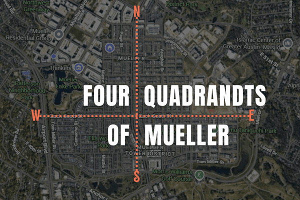
What followed was a neighborhood built in phases. One way to understand that progression is to draw two lines through the Mueller map.
Looking at Mueller in Four Quadrants
Berkman Drive runs north to south through Mueller. Zach Scott Street runs east to west.
Use those two streets as dividing lines and Mueller can be viewed as four general quadrants:

Southwest: south of Zach Scott, west of Berkman
Northwest: north of Zach Scott, west of Berkman
Northeast: north of Zach Scott, east of Berkman
Southeast: south of Zach Scott, east of Berkman
It’s important to note that these lines of demarcation are NOT official Mueller planning districts. They're simply a useful way to see how development moved across the former airport property and how the character of the neighborhood changed as it grew.
To follow that story, we'll start in the southwest.
Southwest Mueller: Where the Residential Story Began
Mueller's first residential development was concentrated in the southwest portion of the property.

The first family moved into a Meritage yard home on Emma Long Street in 2007. Early residential streets developed around places that remain familiar neighborhood landmarks today, including Ella Wooten Park and the Southwest Greenway.

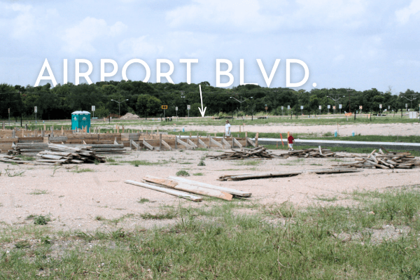
For those first residents, however, much of the Mueller visible today still existed on development plans. Roads ended at empty fields, orange barricades, and sometimes at eerily unfinished alleys. Future sections remained undeveloped. Construction surrounded the relatively small collection of completed homes.

The Southwest Greenway and Lake Park officially opened in 2008, adding significant public green space as Mueller's first residential community took shape.

Later residential development continued to add new housing types to the southwest quadrant, including multifamily and condominium projects.
But this portion of Mueller remains an important starting point for understanding the neighborhood's development: this is where Mueller first became home.
Northwest Mueller: Building the Mixed-Use Center
As development expanded north and west of the Berkman and Zach Scott intersection, Mueller increasingly began to resemble the mixed-use community envisioned in its original plans.
The northwest quadrant contains many of the destinations now most closely associated with Mueller.
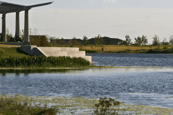
Girard Kinney Lake Park - or just Lake Park as it was known until 2025, occupies a major portion of the area, while the Aldrich Street district combines restaurants, retail, entertainment, housing, offices and cultural institutions.
This quadrant also includes major community and regional destinations such as Dell Children's Medical Center, the Thinkery, the Austin ISD Performing Arts Center and Austin Energy's headquarters, alongside employers, hotels, apartments and condominiums.
Many of those pieces arrived over a long period of time.
The Thinkery opened in Mueller in 2013. The Performing Arts Center followed in 2015. Aldrich Street's first businesses opened in 2017. Texas Mutual opened its Mueller headquarters in 2018, and Origin Hotel opened in 2022.
Housing continued to fill in alongside them.
The result is one of the clearest examples within Mueller of the mixed-use idea that shaped the redevelopment plan: homes, jobs, recreation, entertainment and services located within the same part of the community.
Northeast Mueller: Expanding the Residential Footprint
Development east of Berkman continued Mueller's residential expansion while adding more of the infrastructure necessary to support a growing population.
The northeast quadrant includes a substantial mix of attached and detached housing, multifamily development and neighborhood destinations.
H-E-B opened in Mueller in 2013, bringing a major grocery store into the community as part of the Market District. The quadrant also includes Austin Film Studios, Jesse Andrews Park and Carillo de Garcia Park.
As development continued farther east, another major piece of neighborhood infrastructure arrived: Dr. General Marshall Middle School, which opened in 2023.
The progression illustrates an important part of Mueller's growth.
New phases weren't simply adding houses. Residential development was accompanied over time by parks, schools, retail and other destinations that made it possible for more daily life to happen within the neighborhood.
Southeast Mueller: The Later Stages of Development
The southeast quadrant represents some of the later stages of Mueller's residential expansion.
Housing extends through this section alongside a network of green spaces that includes John Gaines Park, Taniguchi Park and the Southeast Greenway.
The quadrant also includes a range of housing types, from single-family homes to multifamily and condominium development, including Wildflower Terrace and Rivette Tower.
As these later phases were completed, Mueller's trail and park systems continued to expand with them.
In 2025, Mueller opened Roger Levon Taylor Sr. Plaza near the former airport control tower, marking the opening of the community's final planned park.
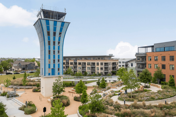
Nearly 18 years had passed since Mueller's first residents moved in.
A Neighborhood Designed to Get Denser Toward the Center
Looking at the four quadrants also makes another element of Mueller's planning easier to see: the neighborhood isn't uniformly dense.
Housing types and densities change as you move through the community.
Portions of Mueller's perimeter include larger detached homes and lots. Moving toward the town center, the housing mix increasingly includes row homes, townhomes, apartments, condominiums and mixed-use buildings.
That variation helps Mueller accommodate different housing types while concentrating more residents near commercial areas, parks and other neighborhood destinations.
The plan itself also evolved as Mueller was built, including changes that allowed additional density in some portions of the development.
The result is a neighborhood where the physical form changes noticeably from one section to another, even though those sections are connected by the same larger street, park and trail networks.
From Four Quadrants to One Neighborhood
Today, it can be difficult to see the boundaries between Mueller's development phases.
The streets connect. Trails run through multiple sections of the neighborhood. Residents from one quadrant use parks, schools, restaurants and businesses in another without giving much thought to when any of them were built.
That's partly what makes looking at the map this way useful.
The southwest shows us where Mueller's residential story began.
The northwest demonstrates the growth of its mixed-use center.
The northeast shows the continued expansion of homes alongside the infrastructure of everyday life.
And the southeast brings us into the later stages of Mueller's development.
Together, they show how a former municipal airport became a neighborhood over the course of nearly two decades. But building homes, streets, parks and businesses is only part of that story.